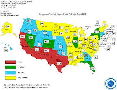
A choropleth map compares areal data between geographic divisions like states and counties.
This particular map shows the percentage of Persons of Hispanic Origin in each state in the year 2000.
Choropleth maps are either standardized or unstandardized depending on whether the data has been areally averaged.
This is a standardized map because the data is relativized to a commom denomenator (percentage).
web site: http://www.sitemaker.umich.edu/356.haas/files/us_map.jpg
No comments:
Post a Comment